Two years, 13 parks, and hundreds of details: a unified navigation system for the Carpathians
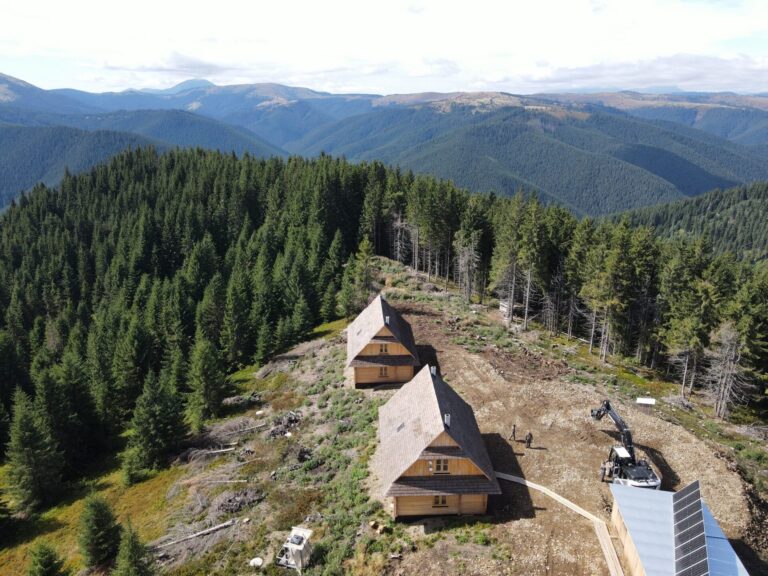
This year, FZS together with 13 national parks of the Carpathians began implementing a unified system of information facilities. In total, 855 units were prepared — including entrance signs, large information boards, and warning signs. At the moment, these facilities are already being installed in 4 national parks, and by the end of the year, they are expected to be in place in nine more.
The project took more than two years to implement, under the supervision of Serhiy Pidmogilny, FZS Ukraine’s coordinator for tourism development in protected areas. We asked the expert to share some behind-the-scenes insights, and here are his brief answers.
A unified style
To grasp the scale of this project, it’s important to understand that previously each park had its own approach to creating information stands. Different styles, different methods — often even within the same park.
Our task was to use the existing brand book to create a style that would be universal, recognizable, and clear across the entire Carpathian region. A style that would remain consistent from one protected area to another. This way, visitors know what to expect from the signage — they can easily read the text, map, or infographics.
I have seen such a unified style of national park information systems in the USA, Israel, France, and a number of other countries.
Types of stands
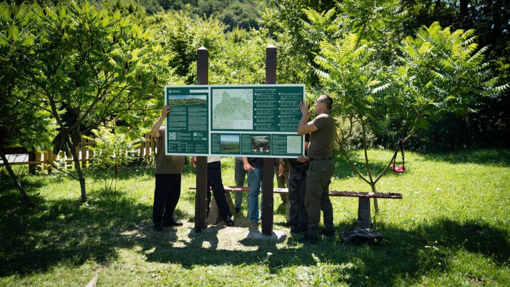
There are three formats: large, small, and panoramic.
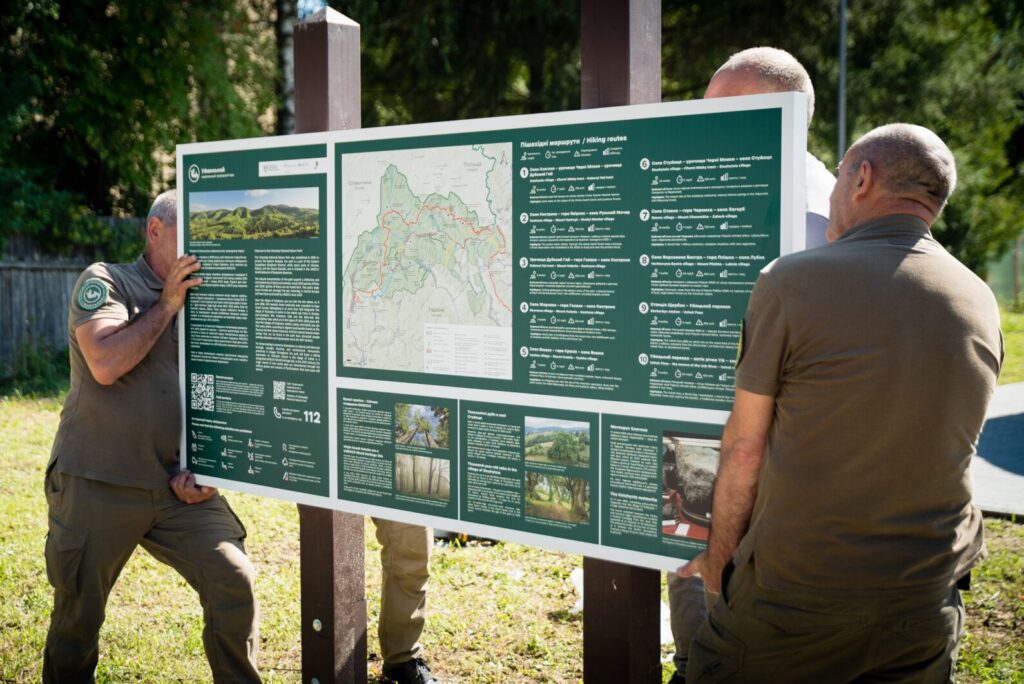
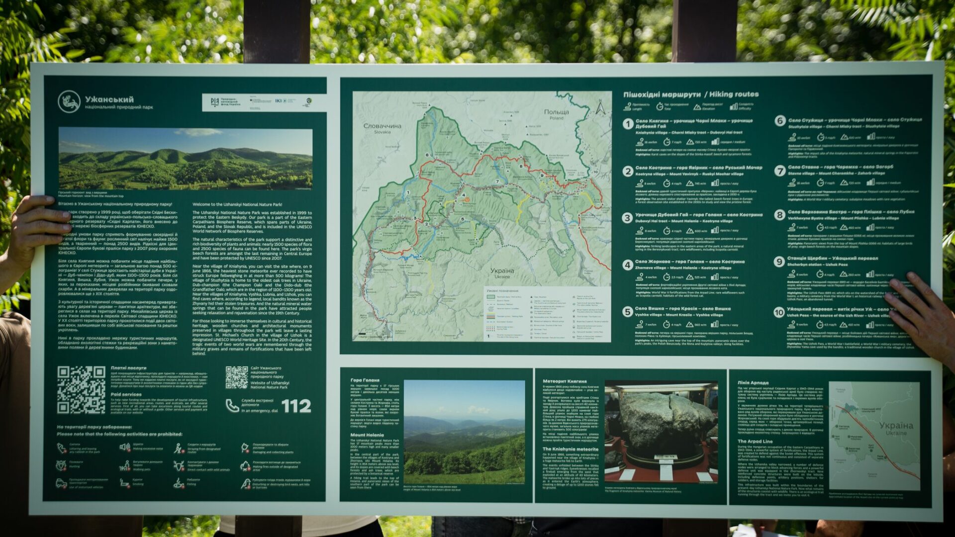
Large stands (180×90 cm or 180×120 cm) contain a map with possible routes, general information about the park, QR codes for paid services or the park’s website, and emergency contacts. On the right-hand side, we provide details about nearby attractions. Large stands are placed in areas with the highest concentration of visitors: railway stations, bus stations, near park administrations, visitor centers, and at trail intersections.
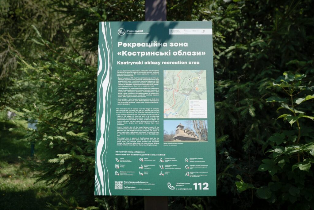
Small information stands are installed along hiking routes. They describe the flora and fauna found in the area, as well as notable cultural or natural heritage sites.
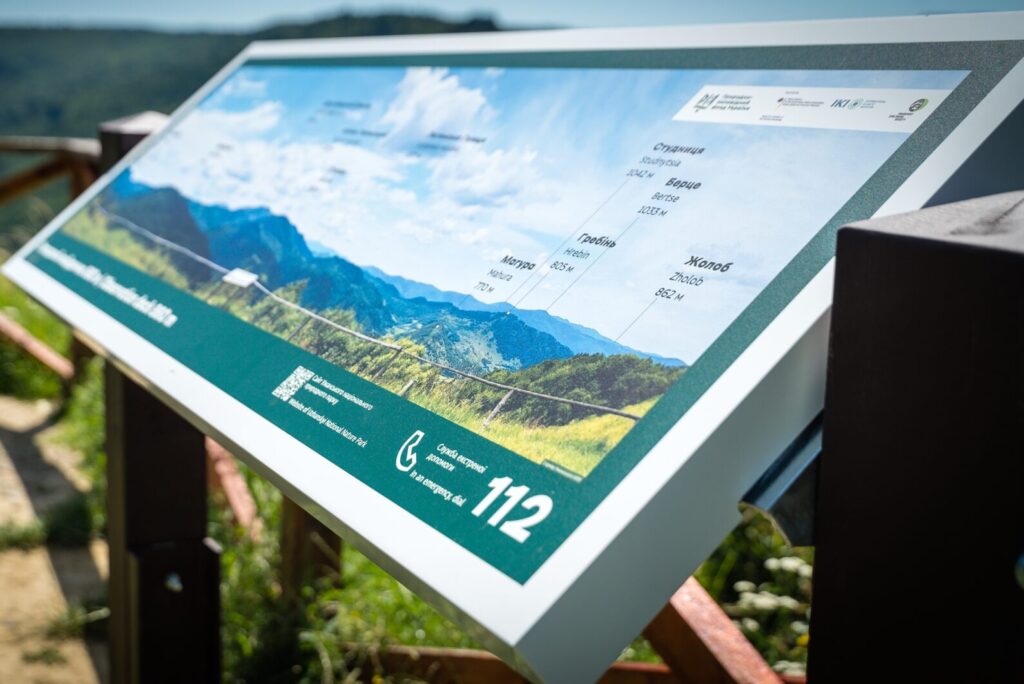
Panoramic stands are located at viewpoints to help visitors identify the surrounding mountain ranges and other landmarks visible before them.
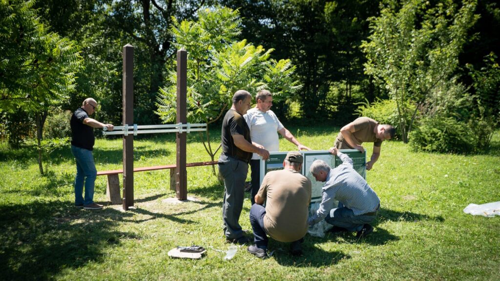
One stand — a big team
Filling each and every stand was a meticulous process that stretched over two years. First, we had to define the logic of how information should be presented — how to arrange different types of content within the set dimensions. Our solution was a modular approach.
For example, a 180×90 cm stand is divided into three sections. These sections can either be vertically symmetrical or consist of one vertical and two horizontal blocks. This flexibility allowed us to adapt to the content while keeping everything within a consistent format.
In addition, almost all information carriers include an English translation, for which we engaged native speakers.
Visual Content
The project was delayed due to poor-quality content or simply a lack of it — especially photographs. Many images were provided by national park researchers, but their resolution was often too low for printing. So we had to dive into FZS’s own archives and hire professional photographers. I’d say that half of all the photographs featured on the stands are thanks to our team. Every image was carefully credited with copyright and the photographer’s name.
In addition to modern photography, we also used retro photos and fragments of old maps. Overall, the visual content across the stands is diverse. For the “Enchanted Land” National Park, we wanted to illustrate the volcanic mountains located on its territory. Since the park didn’t have any images of them, we dug into scientific articles and, together with the park staff and designer Tetiana Kabakova, searched for ways to visualize volcanism through 3D maps so visitors could actually notice it.
Stand Structures
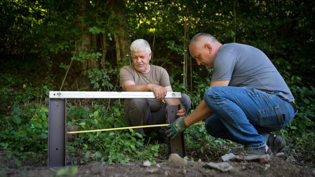
We also had to invent a special structure that would allow the stands to be assembled without electric tools. In parks like Verkhovyna National Park or other high-mountain areas, there are locations you simply can’t reach by car. So the stands had to be designed in such a way that they could be mounted with nothing more than a wrench.
Finding the best manufacturer of stands on the Ukrainian market was critical. Quality was key — after all, the stands are exposed to all weather conditions. That’s why each frame is welded, galvanized, and coated with water-resistant materials. The surface also has UV protection against fading, with a 7-year warranty.
We tried to refine every single element. The metal anchors that protrude from the ground were coated with powder paint. Wooden supports, prepared by FZS carpenters, were fixed to them with three screws. Even here, the carpenters paid maximum attention to detail — cutting the top of the wooden posts into a pyramid shape so that rain or melting snow could flow off without damaging the wood.
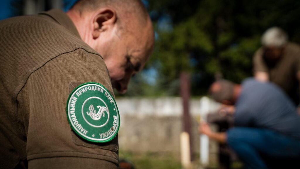
On Cooperation with the Parks
We started the project with an inventory of all existing stands — mapping their locations to see where they were missing, and marking those that were worn out or damaged. Together with the national parks, we agreed on where new stands should be placed, what formats they should have, what content they should present, and what logic should guide them.
The next step was analyzing hiking trails, updating their networks, and creating new maps for the information stands. Not all national parks had interconnected trail systems. For example, in Verkhovyna National Park, they were practically nonexistent. Over the course of more than a year of work, we developed a new trail network together with the park. This network formed the basis of the maps for the stands and, I hope, will be marked and signposted in the future.
What I value most is that, throughout the process of developing the new information materials, the parks themselves began to see the bigger picture. In this collaboration, the parks learned from us the logic of how to structure and place the stands, and together with our team, they adopted approaches to design and to writing compact, engaging texts.
In Lieu of a Conclusion
Behind the scenes there were countless small details — nuts, bolts, and paperwork. At first glance, updating information and navigation may not seem like a difficult task. But in reality, it involved a great deal of organizational, planning, and strategic effort. And the national parks were learning this along the way as well.

News